The Shape of Rain
Rain, rain, won't you stay? And come again another day!

What does rain look like? I don’t mean the drops themselves (though that is a fascinating and complicated story in its own right), but the collection of these drops as they fall. When I think back to early memories of rain, most of what comes to mind is being in the rain: cool prickles on my skin and white noise1 in my ears. I can’t think of many young impressions of seeing rain in the distance, likely a consequence of growing up in a hilly region with no summer rainstorms. But in recent years I’ve been paying more attention to what rain looks like from afar. It can look like one big deluge or it can be made of thin filaments. It can be wispy and evaporating or it can be solid and formidable, spreading like a cloth as it falls. Much of the time, rain doesn’t even reach the ground. But when it does, it can look climactic, as in this timelapse of sailing into a rainstorm on the Bay of Bengal.
(To see photos and videos from this post in full-size, check out this album.)
Meteorologists define two types of rain: “stratiform” and “convective”. Stratiform rain is the kind that’s steady, lasts for an hour or more and likely never gets too strong. It falls from clouds that blanket the entire sky. Unfortunately, stratiform rain doesn’t have a very compelling appearance: it’s usually just gray, uniform skies (sorry, Cascadia!). Convective rain, on the other hand, creates all kinds of churning clouds and beautiful bands of rain. This is the kind of rain that can seem to come out of nowhere and absolutely drench an area for 20 minutes before vanishing, often leaving sunny skies behind. Of course, the real world defies categorization, and large rainstorms will generally contain a mixture of these two types of rain. But for this post, I’ll focus on what convective rain looks like from afar.
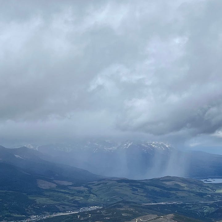
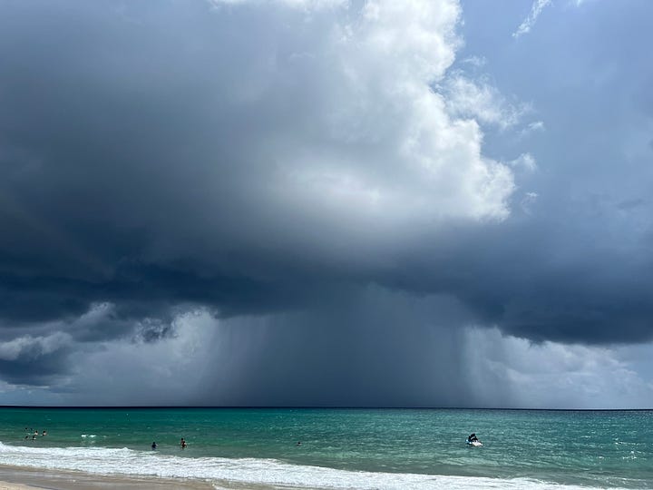
The defining visual feature of convective rain is its precipitation shafts. In timid cases, they may look merely like mist connecting the cloud base to the horizon, but in a vigorous storm they may look like a dark gray mass spilling to the earth. Convective rain is patchy by nature, so these shafts will often look small in the distance and can sport fine structure, alternating between highlights of heavy and light strands of rain.
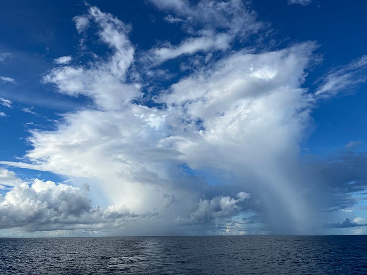
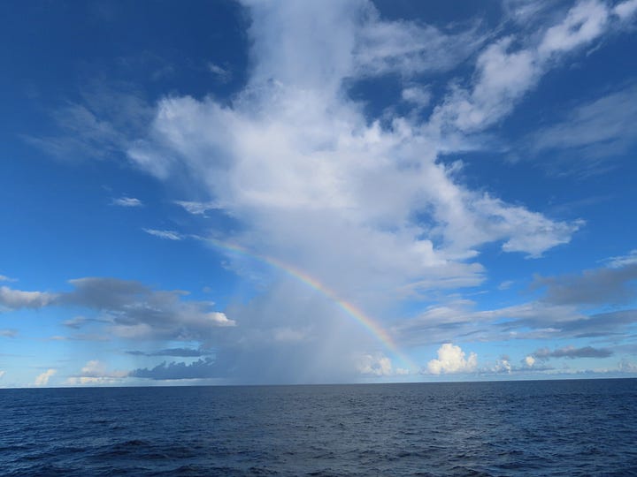
When watching rainclouds on the Bay of Bengal, I found that they often took on a characteristic shape formed by two main regions of precipitation (see the pictures below). At the base of the cloud was a dense veil of rain formed by the strongest downdrafts in the storm. This region would stretch from the ocean up to the cloud base, typically around 2000 feet. This is impressively tall by human standards (about twice as tall as the Eiffel Tower), but positively puny compared to the bulk of the cloud.
The second precipitation location was the “head” of the cloud: as the cloud’s updrafts grew, they would typically encounter stronger winds, pushing them farther ahead of the cloud. At the same time, these updrafts would cool and condense, disappearing into rain or ice that drifted downward. This precipitation would usually evaporate or sublimate back into water vapor before reaching the ground, making it virga. But if the falling water or ice managed to land in a lower part of the cloud, it could merge with that cloud water to enhance the rainfall at the surface.
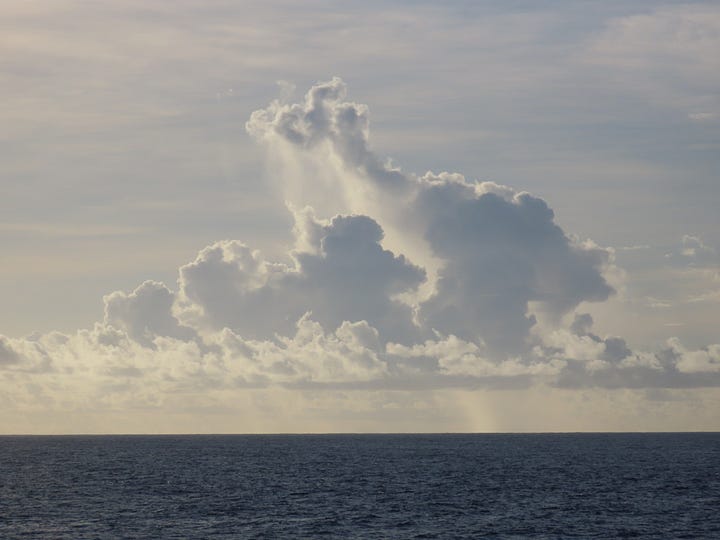
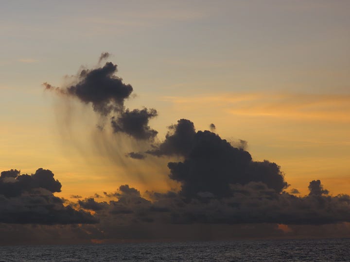
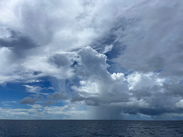

What do you see in these clouds? A camel, AT-AT, goose, or something else? We can see one of these long-necked clouds in motion just before sunset in the timelapse below, putting up a staircase of updrafts that dropped precipitation in a hydra-like cluster of heads.
When we managed to get up-close and personal with one of these clouds, its full structure was no longer visible to us, its head blocked by the thick cloud mass over our ship. But now we could see the awesome detail of its roiling underside and the downdraft of rain at its feet. The air at the base of the cloud was a morass of air motion, with a landscape of gusts moving upward and downward while water flitted between its liquid and vapor forms. The filtered sunlight through the storm took on the full beauty of grayscale, painting the intricacy of the cloud through austere contrast.
The experience of rain is quite different from culture to culture and place to place. But upon seeing the beauty of these rainclouds, how could you call them bad weather? Perhaps stratiform rain is harder to love (though I still do), but getting a good view of convective rain is one of the most wondrous experiences in nature, and it’s a joy to see it imminent in the forecast. Of all the hills I’m willing to die on, that’s the one on which I’ll stage my largest soapbox.
Technically, pink noise!


Beautiful time lapse and description of the rain clouds! The way the patterns shift and evolve over time is truly mesmerizing. Thanks for sharing this peaceful and dynamic view of nature."
Thank you Alex! Beautifully observed!