
Pikes Peak Experience
Moments of wonder up and down the mountain

When you’re about to drive up a mountain to see beautiful vistas, sometimes the best news you can get is, “The peak is closed due to 50 mph winds.” Last month, I found myself driving up Pikes Peak, the prominent mountain overlooking Colorado Springs with a panoramic view of the Colorado Front Range. At first, my heart sank when the ranger at the entrance told me I’d only be able to go up to 11,000 feet before the road would be closed for the high winds. But, as it turns out, blowing that much wind over tall mountains makes for great cloud views all along the way, whether or not one gets a glimpse from the very top.
The first valley view came at around 7,500 feet. I stopped there for a picture and noticed that the clouds looked particularly sheared and ragged in a way that only strong turbulence can produce. I set up a timelapse on my phone and, lo and behold, these were rotor clouds, pockets of water like little explosions in the sky. Rotor clouds are part of the zoo of clouds that form around mountain peaks when strong wind passes over them. First, the mountains push the moving air upward above its equilibrium level. The air subsequently sinks back down, then bounces back up, then back down, just like waves on a pond. At the crests of the wave are often lenticular clouds, the flying saucer-looking clouds that might form a cap on top of a mountain or just downstream of the peak. Below these smooth lenticular clouds, one may see ragged, turbulent rotor clouds born of the wind shear in the lee of the mountain.
There weren’t lenticular clouds visible on this day, probably because there wasn’t enough moisture at the higher level of that wave to condense into a cloud. But there was plenty of moisture in the lowest layer of the atmosphere, and the washing machine agitation of the rotor motion stirred it upward into colder air, where it could condense into evanescent, crashing waves of cloud.
I was struck by the frazzled, shredded look of these clouds. Most of the time, the clouds we see day to day are relatively contiguous, with even shades of gray that slowly vary across the cloud body. As a cloud ages, it will typically begin to fray at its edges, slowly evaporating from the outside in as it mixes with surrounding dry air. But these rotor clouds are born in chaos, tearing themselves apart from the inside almost as soon as they appear.
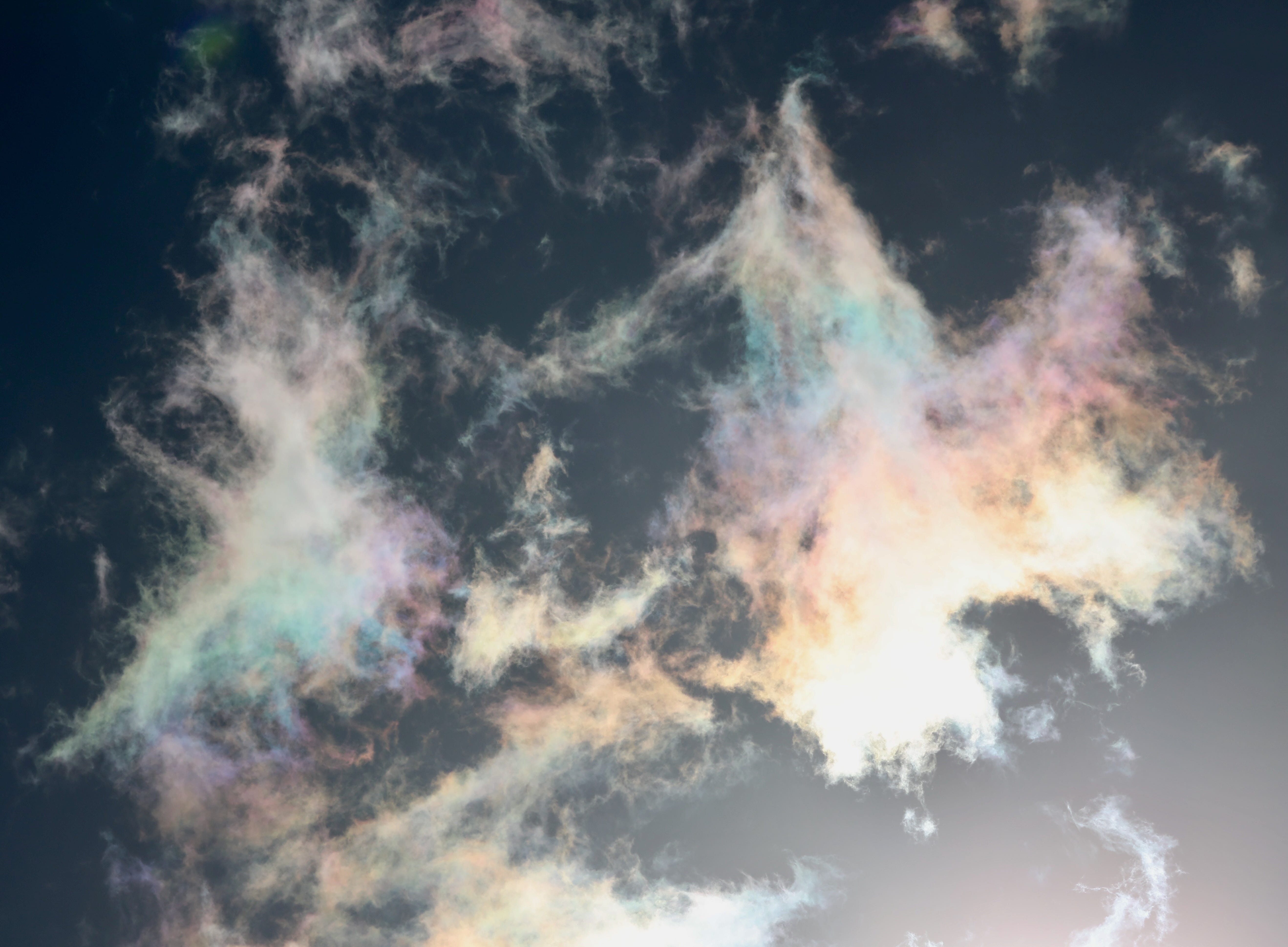
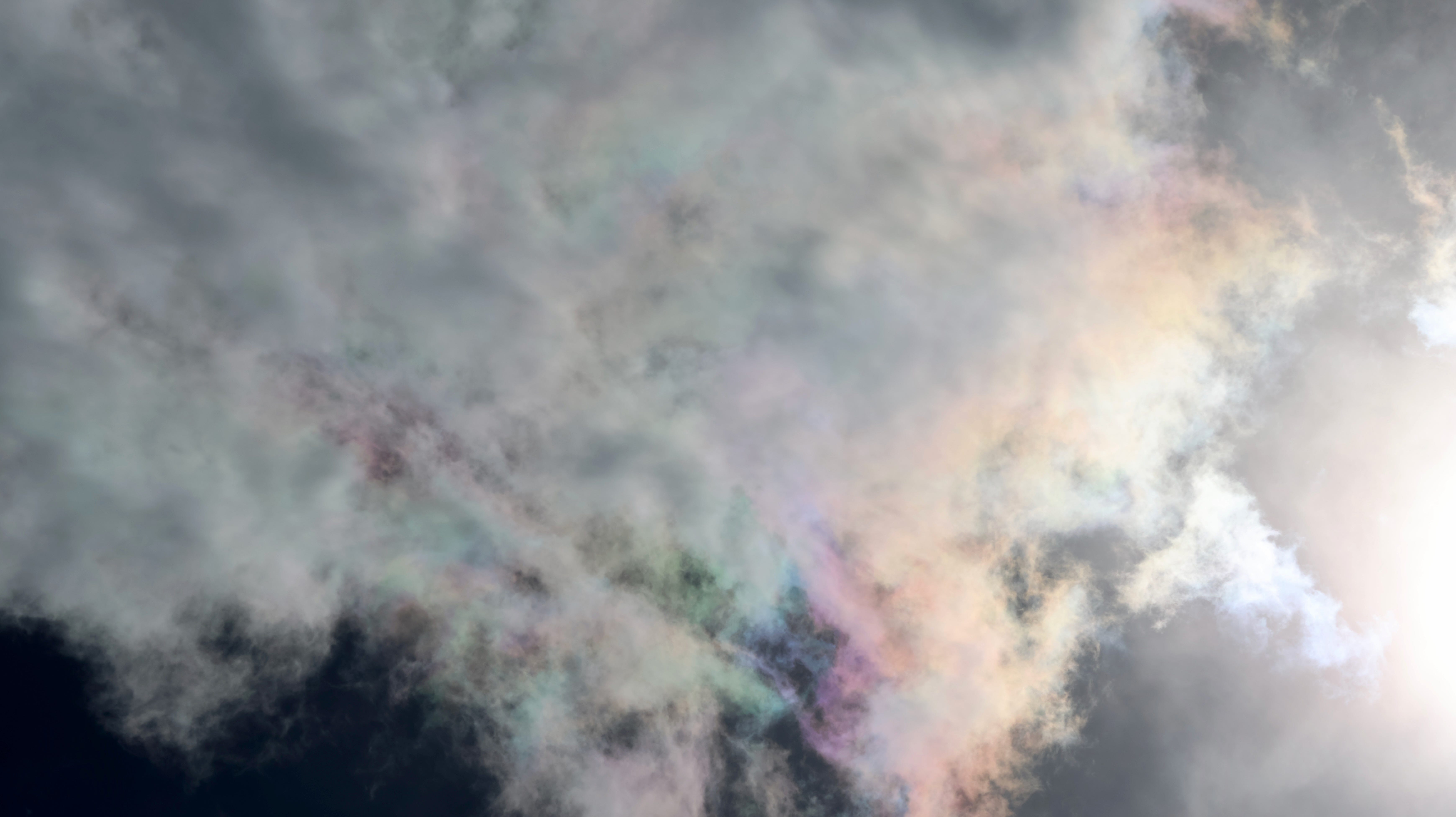
Continuing up the mountain, I found a new treat: iridescent cumulus clouds that brought vibrant colors to the alpine skies. What fascinates me about iridescent clouds is the esoteric color palette with which they decorate themselves. These aren’t the orderly, saturated colors of the rainbow, but a turbulent mixture of hues that can create pearlescent, pastel colorscapes.
Iridescent clouds aren’t actually all that uncommon, they just lurk in a part of the sky that most people rarely look at: a disk of about 20 degrees surrounding the sun, where they can be backlit and diffract the sunlight that reaches our eyes. That’s a place all of our instincts tell us not to look at, unless we’re in the lucky situation where the sun is blocked by another, thicker cloud, or a building, a tree, or your hand. But with polarized sunglasses, you will start to notice iridescent clouds far more often, probably a few times per month.
Iridescent clouds generally aren’t particularly remarkable cloud-wise; if you dragged the cloud to a different part of the sky where it wasn’t backlit by the sun, it would usually just look like a regular cloud. But when you give those small droplets just the right lighting condition, they suddenly take on a vibrant new life.
As I descended back down the western side of the mountain, I spent some time watching the nascent storm that was forecast to bring near-blizzard conditions overnight. This brought yet another cloud treat: a clear view of the inflow into the developing cumulus clouds. At the base of the expansive cloud layer was a hanging bit of cloud, like a table that jutted beneath the rest. I recognized this box as an inflow region where moist surface layer air was being sucked up into the morass of cloud, feeding it from below. Almost all clouds come from rising motion, and here is that motion in one of its purest forms (sped up by a factor of 20 or so for these videos).
Often, inflow regions like this bring to mind the strongest areas of supercell thunderstorms where tornadoes may form. But garden variety cumulus clouds often demonstrate inflow as well, it just doesn’t ascend as deeply into the cloud and doesn’t rotate the way it would in a powerful thunderstorm. When you see part of a cumulus cloud hanging down from the rest, especially in a rectangular fashion, it’s a good guess that’s where the cloud is feeding on the boundary layer air.
I learned last week that Pikes Peak is what inspired the lyrics of America the Beautiful, so much so that the original title was, believe it or not, Pike’s Peak. After this trip to the 11,000’ mark of the mountain, I think I see why Katherine Lee Bates chose her opening line to be: “O beautiful for spacious skies.” The big skies of Colorado fill their space to the brim with beautiful clouds, and the mountains give a flatland-dweller like me a little taste of what it’s like to tower miles up into the atmosphere.
Awesome videos!!
Love the rainbow clouds!